

14 years ago
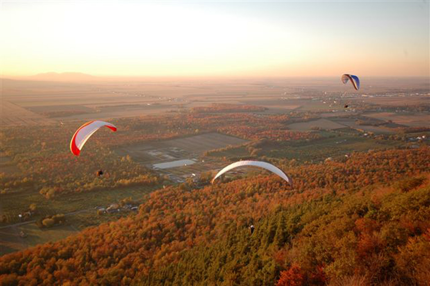
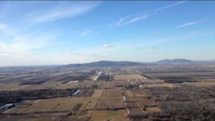
A little mountain of 300 meters high, about 45 minutes East of Montreal, Practically all wind directions except South-Est and North-West (it is still flyable with thèse wind direction but more difficult to gain altitude because there is no ridge to support you if you don't take any thermal). It is a dynamic and thermal mountain. With a good dynamic wind (25-30km/h), you can reach 500 meters easily and with thermals (-5 to +5 meters per second), you can easily reach 1200m (the altitude record is about 2700m). With no wind and no thermal, the sled only last 4-5 minutes and you can't make acro. There is often a combination of dynamic and thermal. There are only trees to save your ass if you make rescue. In shuttle it is about 20-30 minutes to reach the take-offs, depending on the direction, and if you fly North or East, the recuperation is about 30-45 minutes to be back to the start point (640 rang de la Montagne, Distance Vol Libre paragliding/hangliding school). You can also reach the take-offs area by walking on the road and in the forest. It is well known to be an XC start, where pilots often reach 50 km (the distance record is about 117 km to the east). When there is good conditions, you can fly as long as you want, the time record is about 6,5 hours in small conditions but we often fly 1 to 6 hours making acro and XC flights. It is flyable all year long but South and East take-offs are closed in winter.
Do you have a cool footage about Mount Yamaska?
How DTacro will approach the Podium: Helico to Sat to Spiral Landing
Worst Cravat...while trying to improve Twisty Twists

Grounded...by DTacro

First Twisted Rythmics of the season 2015
Best of DTacro 2014
Latest Comments
I wasn't able to put any pictures of the mountain! I will solve this problem soon.